
Follow this guide for a walking tour of Dallas Road, the southern limit of the City of Victoria – teeming with maritime history.
Read the following blog, download the printed version (to print on 11″ x 17″ paper), or stop by the Maritime Museum of BC to pick up a copy!

About this Walking Tour
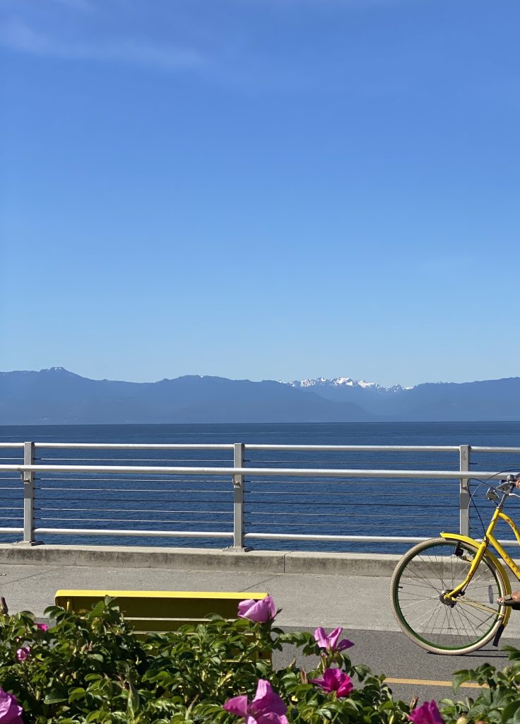
This self-guided walking tour focuses on maritime history along the Dallas Road Walkway, but there are lots of other things to see, including artwork and local flora and fauna including Nootka roses, bald eagles, sea birds, rufous and Anna’s hummingbirds, blacktail deer, Pacific harbour seals, and occasionally whales such as orcas and humpbacks.
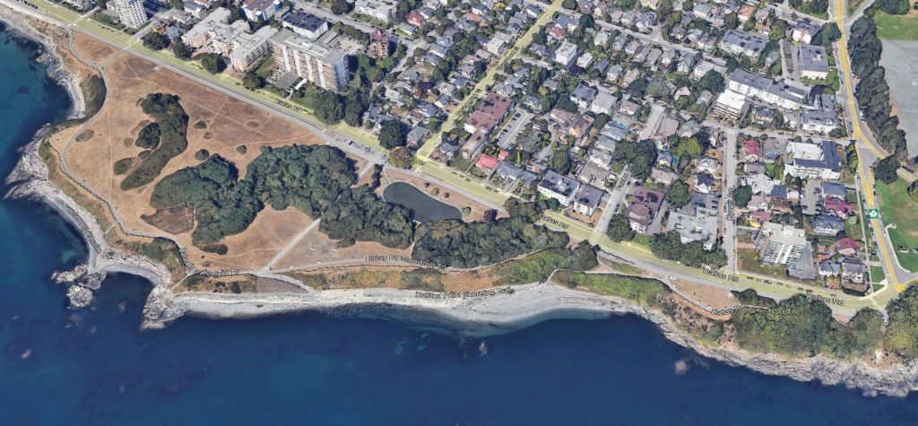
The walkway is approximately 3 kilometres (1.8 miles) in length and should take around one to two hours to complete from end to end. The path is paved and typically ranges from 1 – 2 metres wide. The estimated grade is mostly gentle (5% or less) except for a moderately steep section near Clover Point [Stop 12]. There are two public washrooms along the walkway, as well as many benches and rest areas with views over the water.
The guide starts at the foot of the Ogden Point Breakwater [Stop 1a] heading towards Clover Point [Stop 12], but the walk can start anywhere. Looking out to sea is generally looking southward.
Image caption: A portion of the nautical chart showing the stops along the Dallas Road Walkway. Chart 3440, 2005, Race Rocks to D’arcy Island, Canadian Hydrographic Service, Minister of Fisheries and Ocean
About Dallas Road
Dallas Road is the southern limit of the City of Victoria, near the south end of Vancouver Island. It is on the territories of the lək̓ʷəŋən-speaking people, specifically the Songhees and Xʷsepsəm (Esquimalt) Nations, who have been on these lands and waters for thousands of years.
Dallas Road was named for Alexander Grant Dallas (1816-1882), head of the Hudson’s Bay Company’s Western Region from 1857-1862.
Historical information for this guide was gleaned from the signage and monuments along the walkway and from the comprehensive Beacon Hill Park History, by Janice Ringuette and the Friends of Beacon Hill Park. It was compiled in 2025 by MMBC staff and volunteer Doug VanDine.
Stop 1: Ogden Point Breakwater and Piers
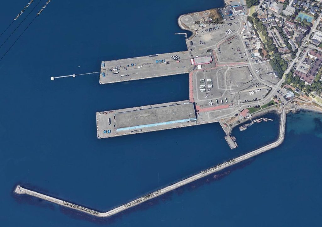
At the entrance to Victoria’s harbour lies Ogden Point and its 760 m-long breakwater and two deep-water piers. Designed in 1912 while the Panama Canal was under construction, the breakwater and piers were built to gain economic advantage when West Coast shipping increased. The breakwater was completed in 1917, and the piers and the Point Ogden Light (at the end of the breakwater) in 1918. The point was named for Peter Skene Ogden (1793–1854), a Hudson’s Bay Company fur trader, explorer, and Chief Factor.
In addition to being shipping terminals, the piers have been used over the years to store grain, as a fish processing/cold storage plant, and as warehouses. Today, you may see one of the 300 cruise ships that tie up at the pier every year, or the pilot boats that moor along side.
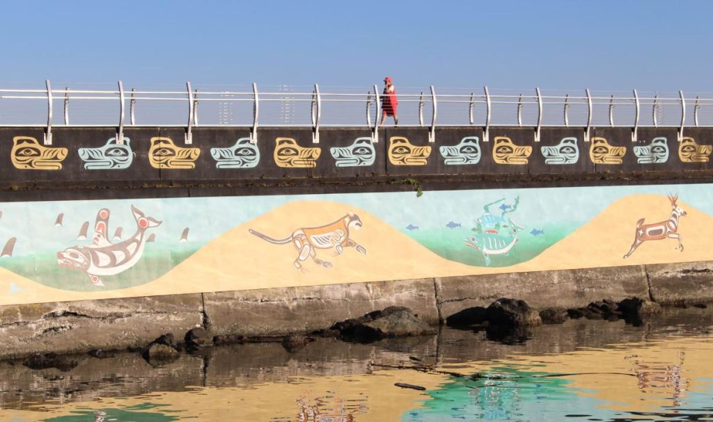
Photo courtesy of the Greater Victoria Harbour Authority.
In 2009, local Indigenous artists under the leadership Clarence “Butch” Dick (Songhees First Nation) and Darlene Gait (Esquimalt First Nation), began to transform the concrete sides of the breakwater into a colourful “Unity Wall” mural to honour the traditions and history of the two nations.
The Ogden Point Breakwater and Piers area is a designated National Historic Civil Engineering Site. In 2019, the area was rebranded to the Breakwater District and is a popular area for walkers, bird watchers, and scuba divers.
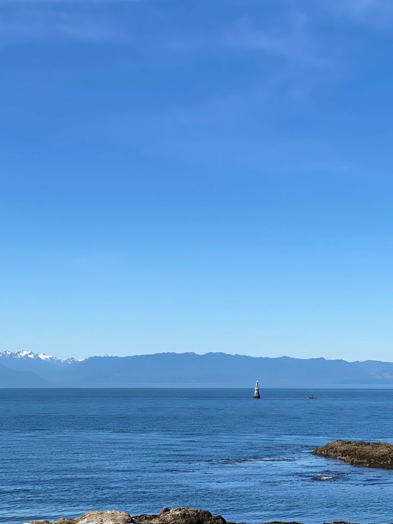
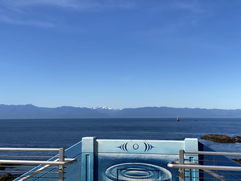
Stop 2: Dallas Road Staircase, Brotchie Ledge Light, and the Strait of Juan de Fuca
Stop 2a
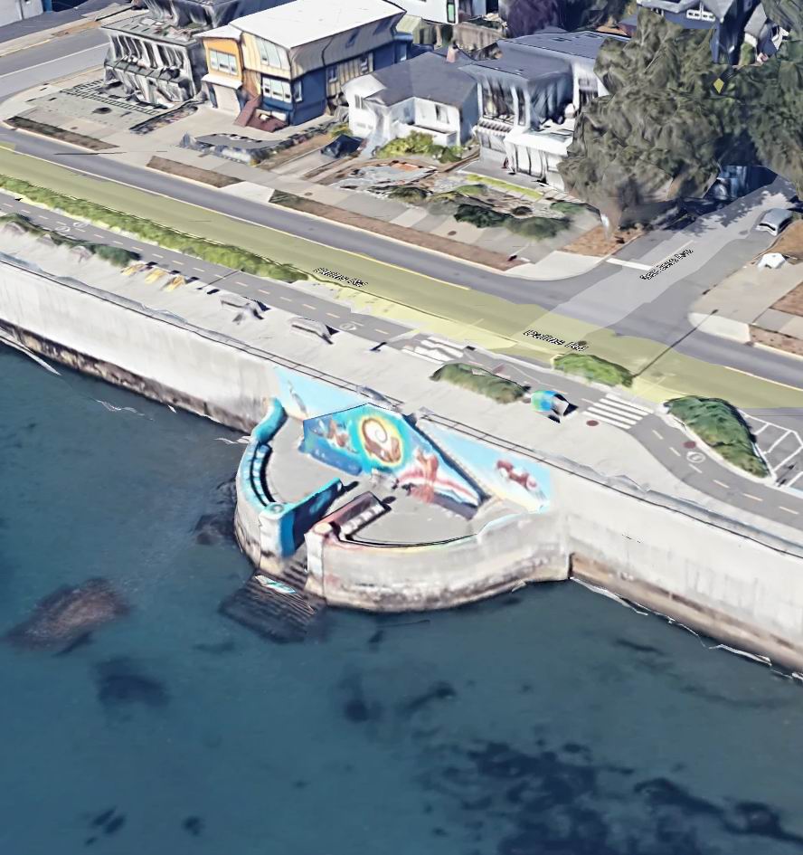
Stop 2a The concrete staircase at the foot of San Jose Avenue is also known as the Dallas Road Swim Pavilion Staircase. In 2021 it was transformed into an art piece called “Ocean of Consciousness”, painted by the FUA! Collective.
Stop 2b The Brotchie Ledge Light can be seen about a kilometre out to sea from the staircase. It warns mariners of the dangerous rocks lurking below. The ledge was known as Buoy Rock for the anchored buoy that floated there until 1849, when the three-masted, Hudson’s Bay Company’s Albion, captained by William Brotchie (1799-1858), hit the rocks.
Stop 2b
In 1891, the steam ship (SS) San Pedro ran up on these rocks (see monument at Stop 3). In 1898, a permanent cylindrical concrete and steel tower were constructed, one of the first navigational aids in Canada to be equipped with an electric light and fog bell. The current light was constructed in 1989. A foghorn installed at the same time was removed after numerous complaints from neighbouring residents.
From 1908-1958, the City of Victoria barged its garbage out to Brotchie Ledge and dumped it. South of the light, the sea floor is still littered with old glass bottles and ceramics, making it an interesting destination for scuba divers.
Stop 2c Beyond the Brochie Ledge Light, the Strait of Juan de Fuca separates Canada from the United States. Looking across the water, you can see Washington State and the Olympic Mountains about 30 kilometres away. The strait was named in 1787 after a Greek navigator by the name of Apostolos Valerianos, who was sailing for Spain under the name Juan de Fuca. There are differences of opinion as to whether Juan de Fuca or Francis Drake, both in the late 1500s, were the first Europeans to sail eastwards up the strait.
Today, the Strait of Juan de Fuca is a major shipping channel for both Canada and the United States. By agreement between the two countries, all inbound shipping traffic sails in US waters and all out bound shipping traffic sails in Canadian waters.
Stop 3: SS San Pedro monument
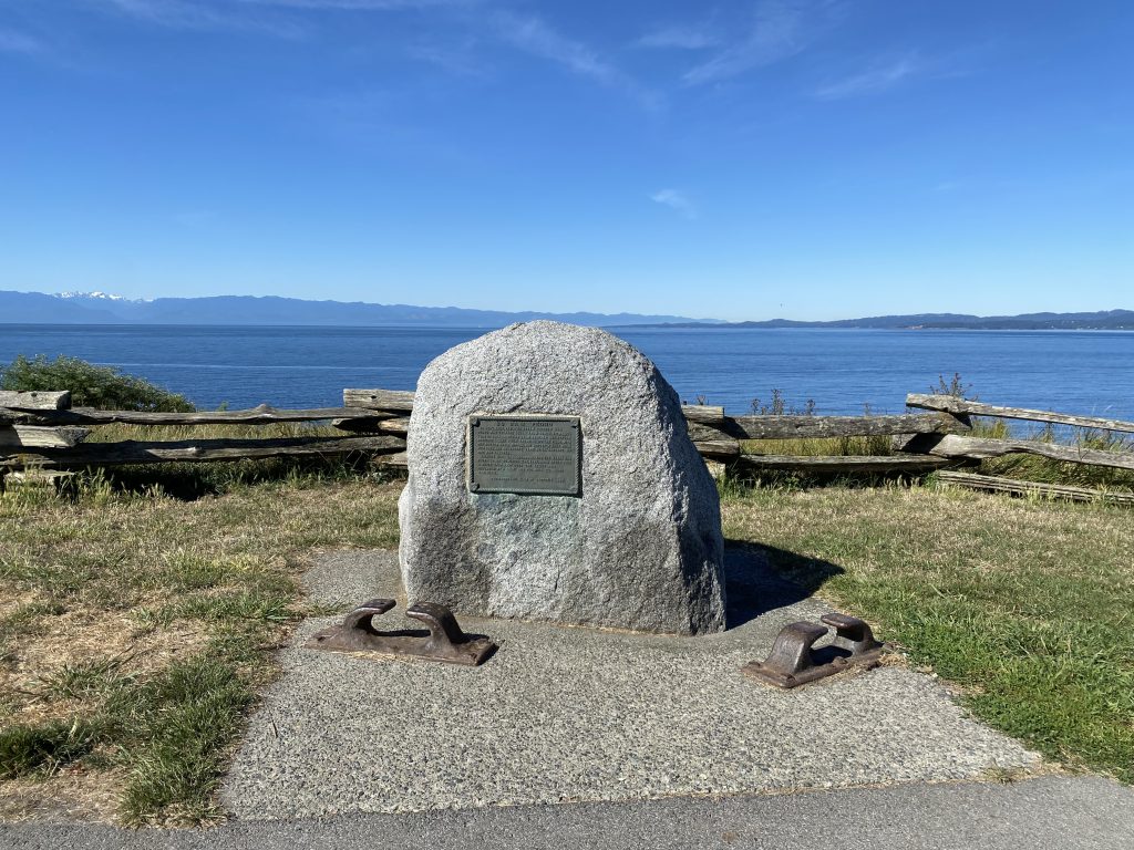
From the plaque attached to the rock monument,
“In November 1891, the steam collier San Pedro was outward bound from Comox with 4000 tons of coal, in clear calm weather she struck Brotchie Ledge while dropping off the pilot. With her bottom badly ripped, she suddenly sank while her crew and salvagers were still onboard. No one was injured. Salvage was unsuccessful and the wreck was blown up on Dominion Day, 1897. Soon after, a white spar buoy over the ledge was replaced by a light and fog bell to warn mariners. [Erected by the] Thermopylae Club of Victoria 1986.”
The monument has two chocks at its base that are presumably from the San Pedro. Chocks are metal fittings on a ship’s deck that guide docking lines from a dock to a cleat on the ship.
Stop 4: Holland Point
From the engraved rock monument along the path, on the west side of Holland Point,
“Holland Point. Named after George Holland, Hudson’s Bay Co. employee who served under Chief Factor James Douglas. Site of an ancient fortified Indian [Indigenous] village. The semi-circular earthwork on the landward side of the village is still visible upon which once stood a wooden stockade.”
This engraved monument was placed here in the 1950s. Today it is quite difficult to make out the “earthwork” on the ground. The term Indian is no longer respectful, and today the term Indigenous would be used.
Stop 5: Harrison Yacht Pond
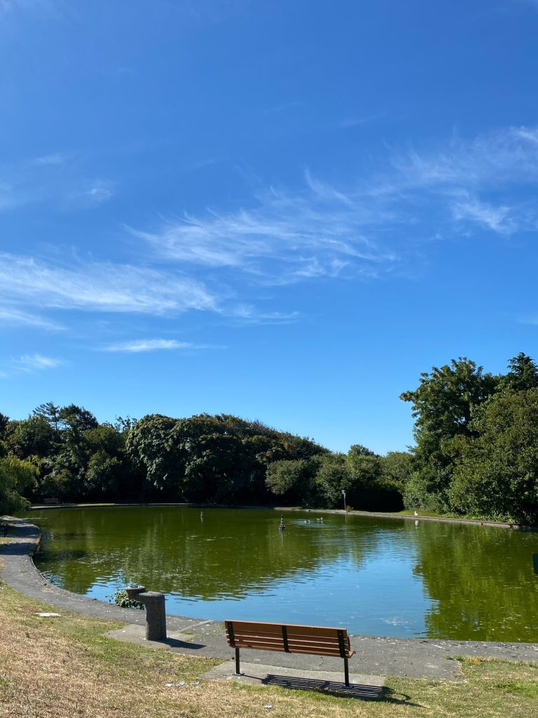
This 80 m x 30 m man-made pond at the foot of Government Street was created in 1956, and dedicated to Claude Harrison, Victoria’s mayor at the time. His idea was that the pond should be “for the fun and enjoyment of model boating Victorians and visitors alike”. Members of the Victoria Model Shipbuilders Society, with model boats of all descriptions, can be seen here most Sunday mornings throughout the year.
Stop 6: Victoria Point (also known as Battery Point) and Glimpse Reef
6a Victoria Point From the engraved rock monument along the north side of the path,
“Victoria Point Battery. Two 64 pounder guns were placed here in 1878 for protection against an expected Russian invasion. Manned at first by volunteers from the Victoria battery of garrison artillery.”
The guns were removed in 1892. It is not known when this monument was placed or why a Russian sea invasion was expected in the 1870s. Russia had sold Alaska to the United States in 1867.

6b Glimpse Reef Looking out to sea and slightly to the west, at lower tides the rocks of Glimpse Reef are visible. Two ships, the Union Oil tanker Santa Maria in 1938, and a 12 m-long US pleasure boat in 1994 have both hit the reef. Although the Santa Maria could be pulled off the reef at high tide, the pleasure boat sank and was lifted off the reef to avoid fuel leakage into the water.
Stop 7: Refurbished Anchor
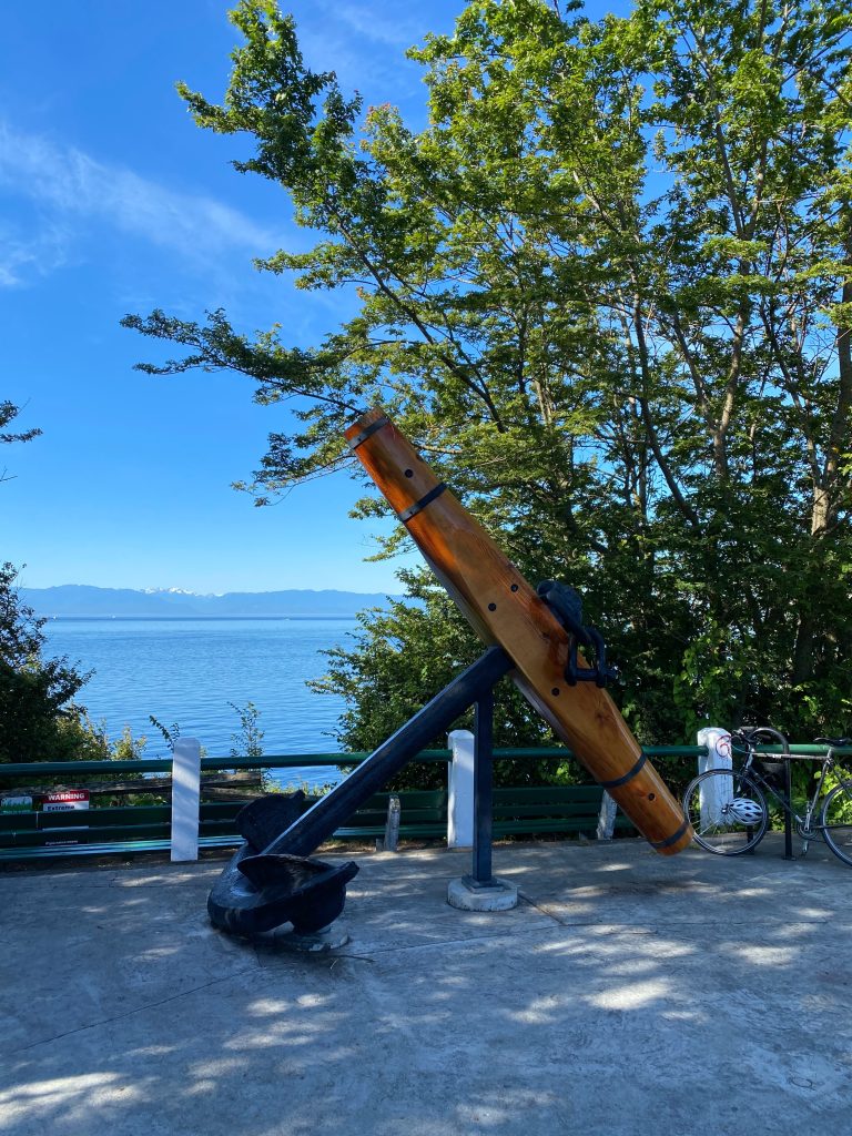
The impressive, refurbished iron and wood Admiralty Pattern anchor was installed across from the foot of Douglas Street in 2021. This anchor is thought to have been pulled from Victoria’s Inner Harbour sometime in the 1960s or 1970s. The anchor was likely from a relatively large 19th century sailing vessel or steamship.
This type of anchor was quite common and manufactured in both Britian and North America in the 1800s. It has a central iron shank that connects two curved iron arms at the bottom with the wooden stock at the top. The long arms have an iron fluke at each end. The original wooden stock has been replaced with a new Douglas fir stock. It is estimated that this anchor weighs about 4 tonnes.
Stop 8: Beacon Hill Park
This area is known by the Songhees First Nation as míqәn or MEE-qan, meaning ‘warmed by the sun’. The Songhees people have hunted, gathered and managed this land for thousands of years. The starchy bulbs of the camas wildflower are an important food source grown in this area.
In 1846, shortly after the Hudson’s Bay Company founded Fort Victoria in 1843, the company erected two beacons on top of what is now called Beacon Hill, where the flag now flies. It is not known when these beacons were removed.
Although used as a park since Fort Victoria was founded in 1843, it was officially reserved as a City of Victoria park in 1858. The 75-hectare (about 185-acre) park has been a jewel in the heart of the city ever since.
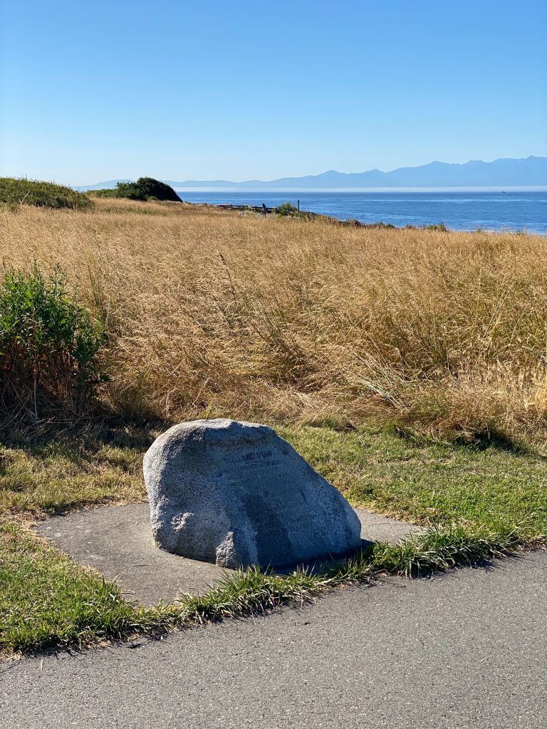
Stop 9: Finlayson Point
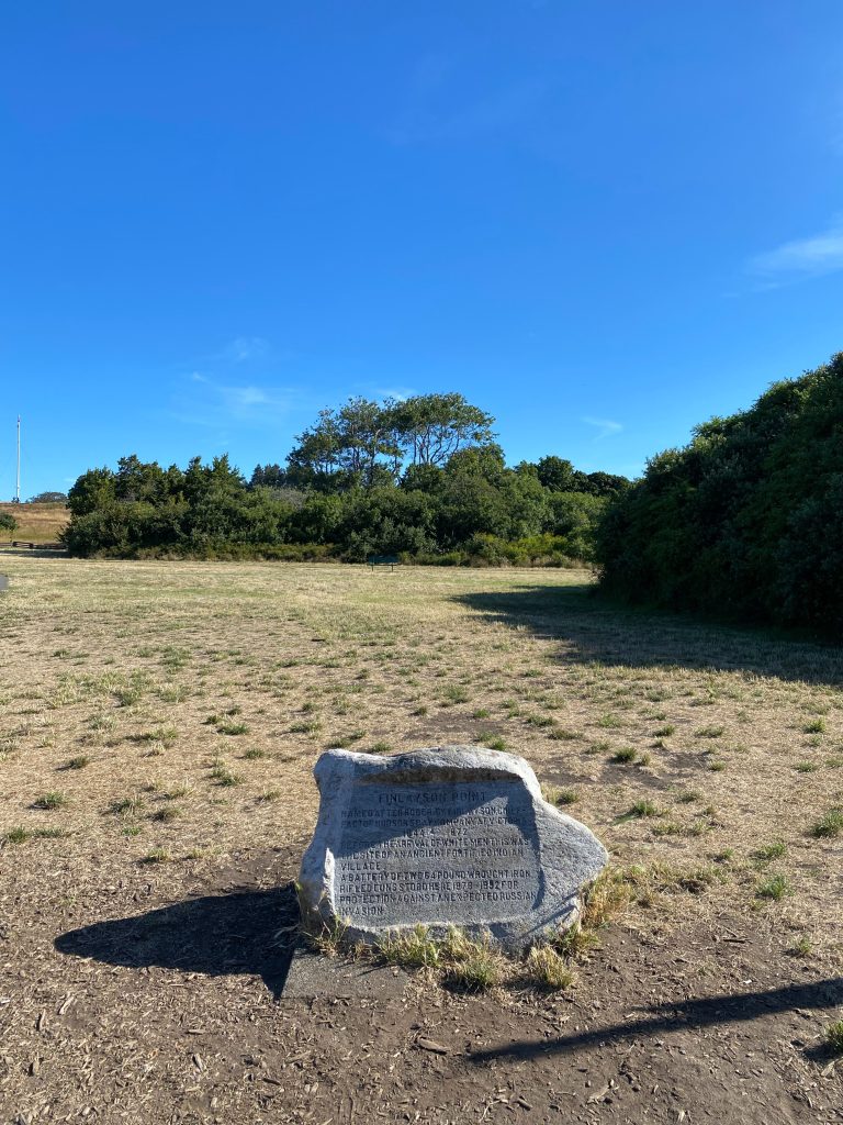
From the engraved rock monument across from the gazebo,
“Finlayson Point. Named after Roderick Finlayson, Chief Factor of Hudson’s Bay Company at Victoria 1844-1872. Before the arrival of white men this was the site of an ancient fortified Indian [Indigenous] village. A battery of two 64 pound wrought iron rifled guns stood here 1878-1892 for protection against an expected Russian invasion.”
Remnants of the fortified village site date back to 950 AD and evidence indicates the area was occupied again 500 years later.
Follow the path behind the gazebo to reach the point and to look over the Strait of Juan de Fuca.
Stop 10: Marilyn Bell Cairn
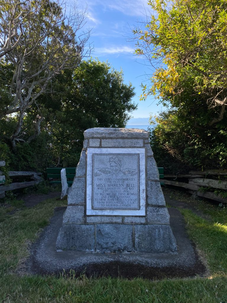
From the cairn, erected in 1957,
“This cairn commemorates the feat of Miss Marilyn Bell who landed in this bay 23th August 1956 to become the first woman and first Canadian to swim Juan de Fuca Strait from Port Angeles, USA to Victoria, Canada.”
Born in Toronto, Ontario, the 18-year-old Bell, completed her ~30-km swim in 10 hours, 38 minutes. It was her second attempt. In 1954, Bell became the first person to swim across Lake Ontario and, in 1955, she became the youngest woman to swim across the English Channel.
Stop 11: Circular Staircase and Turret, east of Cook Street
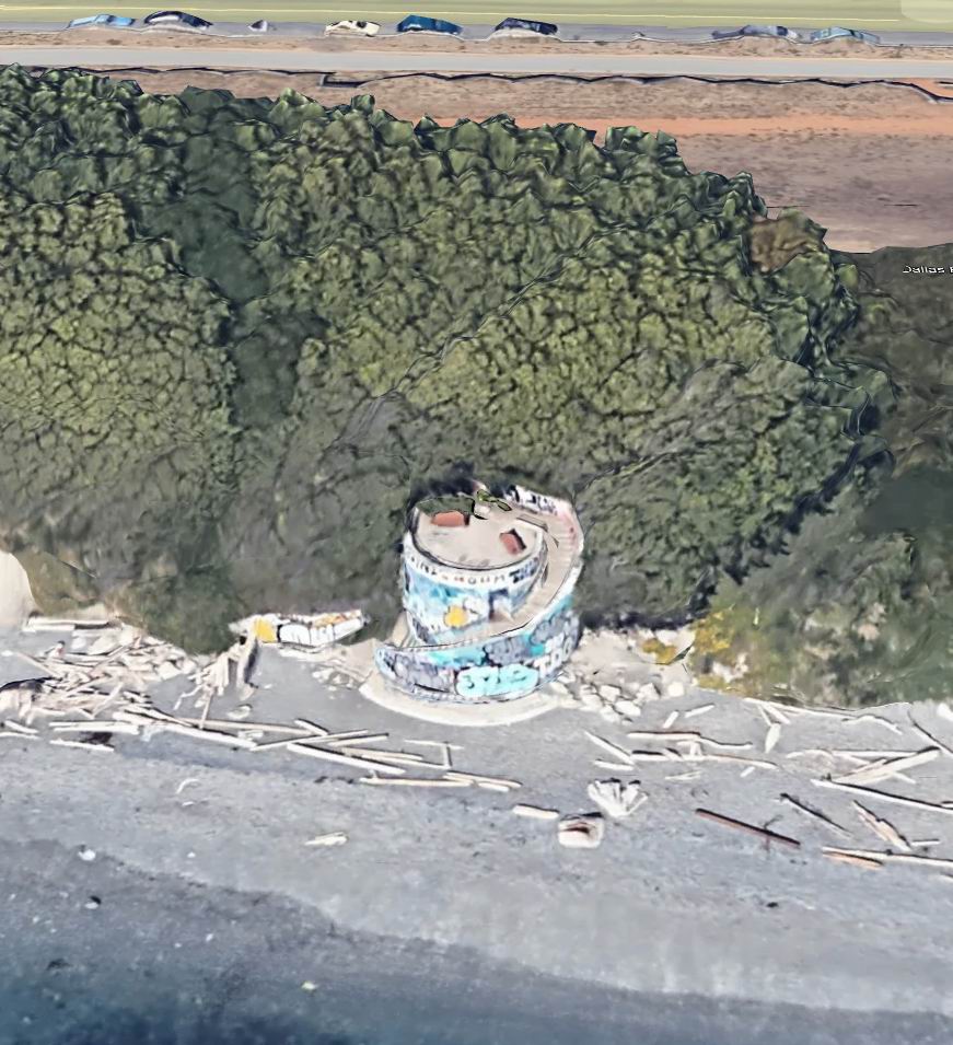
The large circular concrete staircase and turret lead down to a wide, walkable beach.
Captain James Cook (1728-1779), Cook Street’s namesake, was a British explorer and naval captain who made three voyages to the southern and northern Pacific oceans between 1768 and 1779. During his third Pacific Ocean voyage, in 1778, he missed seeing the entrance of the Strait of Juan de Fuca because of fog and landed in Nootka Sound on the west coast of Vancouver Island.
Stop 12: Clover Point
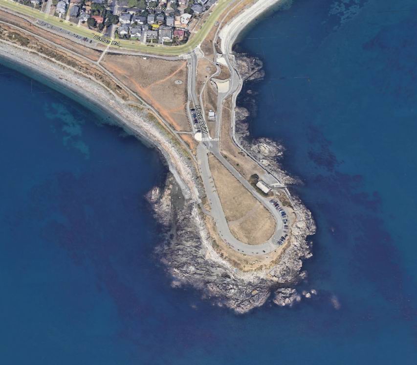
Prior to European colonization, this point was occupied and used by the Songhees First Nation as a defensive site and to cultivate and harvest edible plants including clover, camas, parsley, onions, and ferns.
In the spring of 1842, Hudson’s Bay Company’s Chief Factor James Douglas (1803-1877) landed on Clover Point in search of a location to build the company fort on southern Vancouver Island. He named the area after the abundant red clover growing on the point.
From 1900 to 1931, Clover Point was used as a rifle range. During WWII, two large military searchlights and six barracks for the crew that manned the lights, were constructed on the point. They were intended to help protect Victoria from a possible Japanese naval attack. For a short period of time after the war, the barracks were used as temporary housing for veterans’ families.
The Clover Point Anglers Association has for many years had a boathouse on the point. Since 1930, Clover Point has been associated with the start line of the Swiftsure International Yacht Race, a sailboat competition held each year in May.
What’s Next?
There’s more to do and see every day at the MMBC–check out the links to the right for your next maritime adventure.
Let us know what you learned and how you explored Dallas Road!


